The National Institute for Mathematical Sciences (NIMS) presents a very special NIMS-IMAGINARY exhibition in collaboration with the ICM committee and the Mathematisches Forschungsinstitut Oberwolfach (MFO). It will feature the best of all IMAGINARY modules of the last years and a lot of new software, images, films and sculptures. It will be the biggest IMAGINARY exhibition shown so far.
The Sphere of the Earth
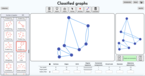
program
Program (zip, Windows installer). See below documentation and other platforms
Licenses
Source code
Credits
This program has been developed by Daniel Ramos, MMACA (Museu de Matemàtiques de Catalunya).
"An Album of Map Projections", 1989, Snyder, John P.; Voxland, Philip M. Credit: U.S. Geological Survey
Department of the Interior/USGS
Contributors
Programming and DesignDaniel Ramos
Related Events

The Heidelberg Laureate Forum Foundation invites you to visit the exhibition “Mathematics of Planet Earth” at Karlstorbahnhof in Heidelberg, Germany! It runs from July 5 to Aug 2, 2015, for the first time in Heidelberg. It offers a big variety of exciting adventures for children and adults alike.
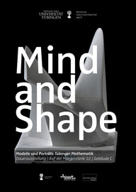
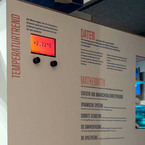
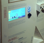
MIND AND SHAPE is a permanent exhibition at the University of Tübingen. It gives an insight into the world of mathematical thought, showing historic mathematical models, portraits of the most influencing mathematicians in Tübingen and a touch screen station.
Mathematics students of the University of Tübingen guide school classes and other interested groups through the exhibition upon request. They were trained to explain the exhibits and communicate the beauty of mathematics in a workshop by JProf. Carla Cederbaum and Sophia Jahns.
If you are interested in a guided visit, please contact frank.loose@uni-tuebingen.de
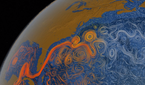
This exhibit explores the science of cartography and the geometry of the sphere. The geometric properties of the sphere and the plane are essentially different, and no map can faithfully represent the Earth without distortion. This module goes through some of these properties, comparing different map projections and trying to get a feeling of what “distortion” means and why is there such impossibility for a “perfect map”.
Studying the problem of representing the spherical surface of the Earth onto a flat map is the subject of cartography, and has been an important mathematical problem along History (navigation, position, frontiers, land ownership…). An essential theorem in Geometry (Gauss’ Egregium theorem) ensures that there is no perfect map, that is, there is no way of representing the Earth keeping distances at scale. However, this is exactly what makes cartography a discipline: developing several different maps that try to solve well enough the problem of representing the Earth.
We present six different map projections that are to be compared with a physical globe. Although all maps are created at nominal scale 1:1 of the globe, the distortion is apparent. We propose several activities with the maps and some tools that explore the properties of each map.
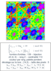
On a second part, we use the program “The sphere of the Earth”, that displays the Tissot indicatrix for each map. This indicatrix is a mathematical graphical tool that helps to understand the inherent distortion of a map. When moving the mouse over a map, an ellipse is drawn around the pointer; this ellipse represents actually a real circle, but the distortion of the map makes it appear in this shape. The inspection of this ellipses at different points tells us a lot of information about the projection properties.
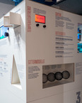
Files to download include the six maps at poster size, the script programs that generate them, the program displaying Tissot indicatrices, a technical manual and a set of proposed activities.
This exhibit was awarded the first prize in the “Mathematics of Planet Earth 2013” competition.