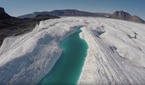
Drone in Greenland
film
Licence
Credits
- UAV operations and data processing:
- Voice-over:
- Special thanks to:
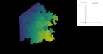
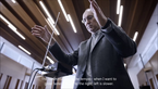
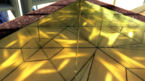
This 5-min-long film shows how scientists use drones to monitor and model the detachment of icebergs (calving) from the Bowdoin Glacier in Northwest Greenland.
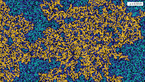
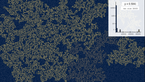
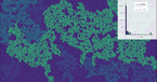
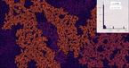
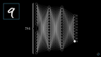
The captured material was used to analyse the calving activity of the Bowdoin Glacier in 2015 by combining satellite images, UAV (unmanned aerial vehicle) photogrammetry and ice flow modelling. In particular, a high-resolution displacement field is inferred from UAV orthoimages taken immediately before and after the initiation of a large fracture, which induced a major calving event. A detailed analysis of the strain rate field allows to accurately map the path taken by the opening crack.
Read more about the scientific results here.
The film as well as the study demonstrates that the combination of UAV photogrammetry and ice flow modelling is a promising tool to horizontally and vertically track the propagation of fractures responsible for large calving events.
Subtitles are available in French, German and English in the file section below.
More Films